
University Portfolio
All geospatial analyses and cartographic projects displayed in this portfolio were created during my undergraduate studies at George Washington University, where I developed a strong technical foundation in GIS, spatial analysis, and environmental mapping. Due to the proprietary nature of my current federal contract work, I am unable to share the maps and analyses produced professionally.
These academic projects serve as a foundation for my current capabilities, demonstrating the technical rigor and analytical approach that continue to inform my work today. Since completing them, my skills have expanded significantly through professional experience supporting federal, state, and international sustainability initiatives. I now conduct advanced spatial modeling, data integration, and decision-support mapping for energy management, renewable siting, and climate resilience—building on and refining the expertise reflected in these early examples.
Click any image to see it in a pop-up in order to get a better look.


ArcGIS
Analysis by Multi-Criteria Evaluation
Two Maps with different parameters to establish where new grocery stores are needed in Washington, DC census tracts. This analysis included obtaining data from various government departments, data normalization, and the creation of a multi-criteria evaluation.
February 2022
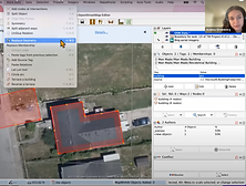
QGIS
Site Selection Using a Model Builder
A graphical modeler was employed to conduct all required actions at once. Thus, intermediate steps did not have to be saved, added, and then removed from the map. For this site-selection, I didn't know exactly which sites would meet all the criteria, so the model I created found them for me. Lastly, it can be re-run as many times as needed and can be edited if the criteria were to change.
February 2023


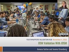
JOSM Software
Trainings Led for YouthMappers Validation Hub
I led a number of live trainings on basic JOSM software, validation of data added to OpenStreetMaps, and advanced mapping techniques while I worked at the YouthMappers Validation Hub from February 2022 to May 2023. There were attendees from all over the world at each of these trainings. Links to three of my trainings, which remain on the YouthMappers youtube page, are underlined to the left.
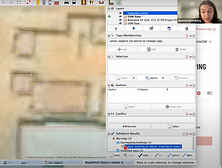
QGIS
Site Selection Using SQL in PGAdmin
All geoprocessing occurred outside of the QGIS interface and was instead conducted using SQL functions within PGAdmin. All SQL code can be viewed in the image below. Some functions utilized include: ST_Difference(), ST_Distance(), ST_Union, CROSS JOIN.
April 2023


ArcGIS
Environmental Conservation Predictions
This map involved using a multi-criteria evaluation where habitats with the highest combination of preferred criteria were delineated as suitable habitats.Paths between suitable habitats were determined using the criteria for the most optimal conditions possible and where the species had already been sighted.
March 2022
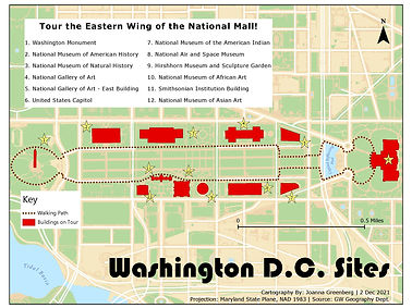
ArcGIS
Guidance Map
This required me to make vector polygons traced over satellite imagery for each of the landmarks. Additionally, I drew the walking path. The map is meant to be appropriate for tourist use, thus the less formal design.
December 2021
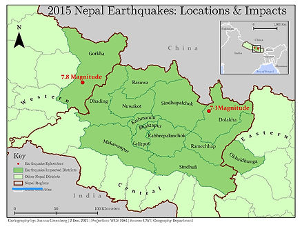
ArcGIS
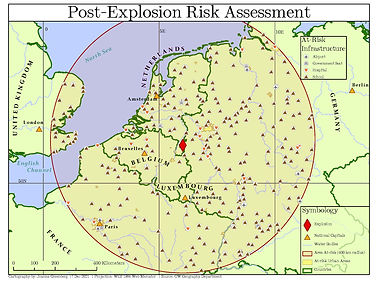
Disaster Impact Analysis with Buffer and Clip Tools
A buffer around a disaster epicenter was created and then all relevant infrastructure was clipped so that only the points within the buffer were displayed.
December 2021
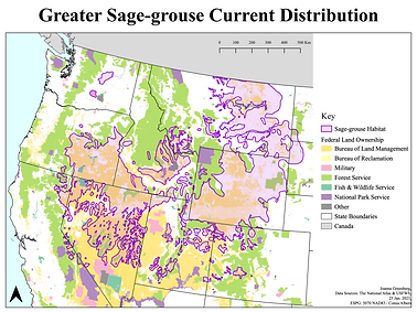
QGIS
Layering and Symbolization based on Bureau of Land Management Criteria
This map demonstrates the use of official symbolization and proper map layering.
January 2023
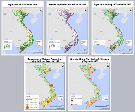
Additional Works
Below are more maps I have created based on a variety of project guidelines. There are various tools and methods used for each.
ArcGIS

QGIS


